
Sand Springs Fire Update: 80% Contained as Smoke Advisory Covers the State
Editor's note: As stated on social media (I should have posted that here first before social media but I will chalk that up to a beginner mistake), I have been away from the Mountainair Dispatch office beginning Wednesday, August 5, 2026, for treatment related to kidney stones and will be back in the hospital to address additional stones in the coming weeks. I will remain available throughout for tips, questions, advertising, and breaking developments on any story - physically when possible (I do not intend this to be an extended leave of absence), by phone and text (719-496-1660, unsecured communication), email (todd@mountainairdispatch.com for unsecured communication; additional email available for higher levels of secure, encrypted communication as conditions warrant it), and Signal (mtndispatch.99). Additional secure communication methods are available under appropriate circumstances for communications and file drops.
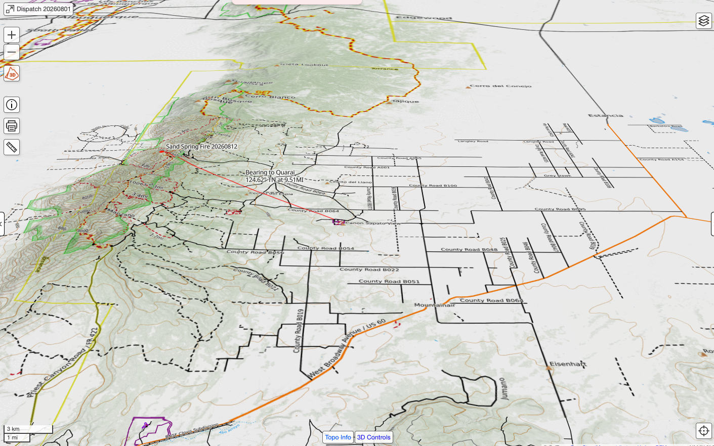
The Sand Springs Fire, burning in the Manzano Mountain Wilderness south of Capilla Peak, is now 80 percent contained, according to Watch Duty, nearly two weeks after a lightning strike sparked it. USFS Representative Arlene Perea, in an email, said the fire did not pose a threat to Torrance County communities at the time of writing.
What Residents Need to Know
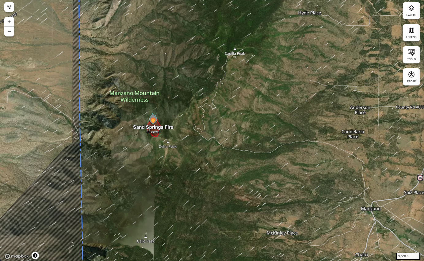
There is no evidence of fire threat to any structures or communities, and no evacuations are in effect, according to the US Forest Service's (USFS) Mountainair Ranger District. The nearest developed area, the communication towers and structures atop Capilla Peak, sits roughly 1.5 miles from fire activity. Smoke has been visible at times from Mountainair, Manzano, Punta de Agua, Torreon, and the west side of the Manzano Mountains.
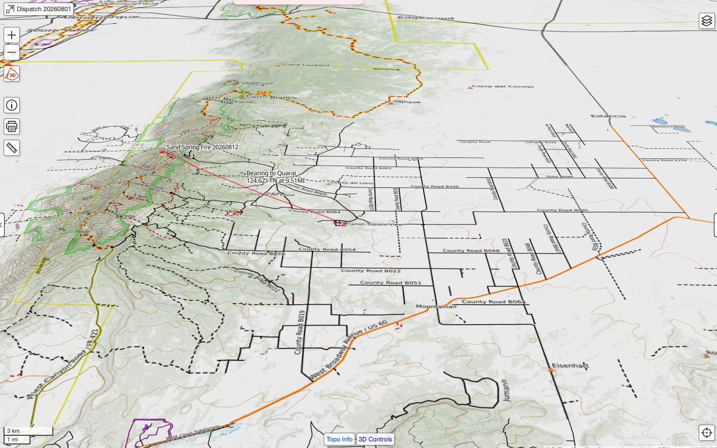
The Capilla Peak lookout first reported the fire at 3:38 PM MDT on Friday, July 31, 2026, in steep terrain north of Osha Peak. It has grown slowly in the weeks since, from an initial estimate of five acres to roughly 30 acres by early August. The most recent perimeter mapped by the National Interagency Fire Center puts the fire at 47.9 acres, now 80 percent contained.
U.S. Forest Service Type 1 Hotshot crews and an unmanned aircraft system module assigned to the fire have used aerial retardant drops and infrared detection to build containment lines around the perimeter, working around fuels described as timber and dead-and-down debris in steep, rugged terrain that slowed ground crews earlier in the incident.
Statewide Smoke Advisory
New Mexico's Department of Health issued a statewide smoke advisory this week as multiple lightning-caused wildfires, including Sand Springs and the much larger Frijoles Fire near Santa Fe County, sent smoke across the state. Health officials recommended residents use the "5-3-1" visibility method to judge local air quality: below five miles of visibility, older adults, pregnant women, young children, and people with heart or lung conditions should limit outdoor time; below three miles, those groups should stay indoors; below one mile, everyone should stay inside.
Stay Informed
Torrance County residents are also encouraged to sign up for TextMyGov emergency alerts to receive real-time notifications tailored to their needs:
- Text TORRANCE COUNTY to 80946 for general notifications and emergency alerts.
- Text TORRANCE FIRE ALERTS to 80946 for information on prescribed burns or active fires in the area.
- Text TORRANCE NWS to 80946 to receive weather-related alerts.
Residents can also track the fire's mapped perimeter directly through Watch Duty and read official Forest Service releases at nmfireinfo.com. For background on how this fire started, see the Dispatch's earlier coverage of the lightning-sparked ignition.