Volunteers Rescue Lost Hiker in Manzano Mountains
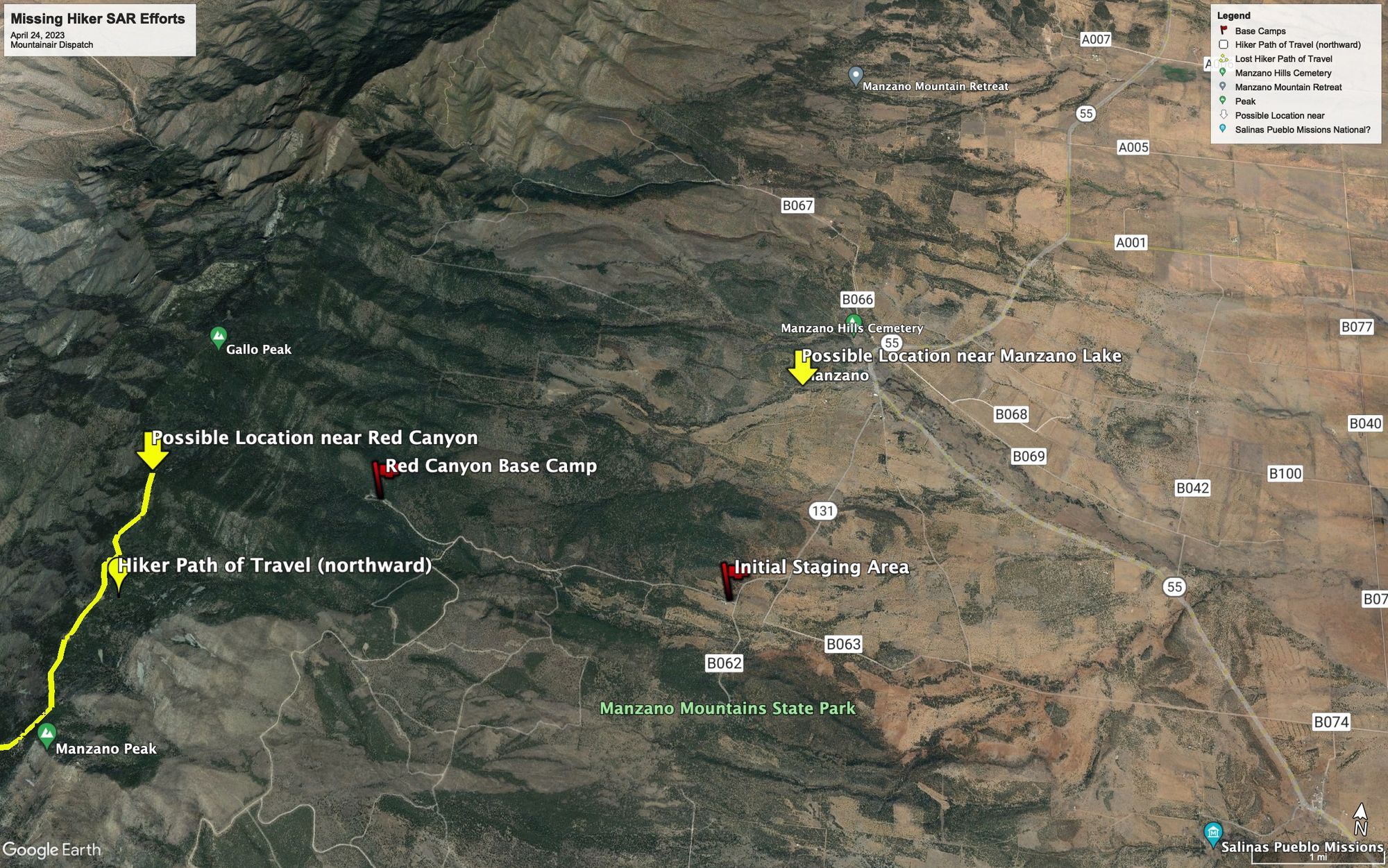
Torrance County Fire Chief Don Dirks looked at the graphical information system (GIS) display on his cellphone. “Right here,” he explained, pointing west of the entrance to Manzano Mountains State Park, off Forest Road 253, “is where his phone last pinged. Now his battery is down to nine percent.”
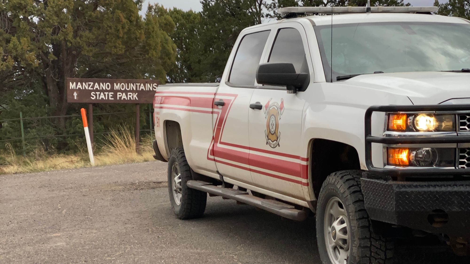
Dirks was part of the team of first responders that had responded to the call in the early afternoon of April 24, 2023 of a lost hiker in his mid-sixties - a man by the name of Tom Sheldon according to Chief Dirks - roaming through the Cibola National Forest for a second day. Search and Rescue (SAR) personnel included members of Torrance County Fire Department, Torrance County Sheriff’s Office, Mountainair Fire & Rescue, the New Mexico State Police, Albuquerque Mountain Rescue, Cibola Search and Rescue, New Mexico Mounted Search and Rescue, Socorro Search and Rescue, and Sandia Search Dogs. By the time Dirks explained Sheldon had wandered off the trail after his hiking partner had left the trip to return to Albuquerque, the temperature had dropped in to the forties, with lightning flashes seen north of Manzano Mountains State Park and the National Forest. Later that night, the temperature would hit the freezing mark.
Dirks said that there was a debate regarding the hiker’s location. When he called 911, Sheldon told dispatch that he saw dogs, cats, and a cow, and that he was near a stream. There were no locations within the state park and national forest near where the cell phone tracking placed the hiker that matched this description. However, the ridges and draws of the Manzano Mountains reflected and bounced cell phone signals. The cell phone ping data could be incorrect, misdirecting rescuers like the will o’ wisp of folklore. Both Torrance County Fire and Torrance County Sheriff’s Office believed that put the lost hiker northeast of Manzano Mountains State Park, near Lake Manzano. Cibola Search and Rescue relied on the cell phone ping data provided by the New Mexico State Police, which placed Sheldon a few miles northwest of Manzano Mountains State Park. Rescuers discussed how the US Air Force could provide more accurate location data using its signals intelligence (SIGINT) tools, but no one knew who to contact with the Air Force to get this process started. Between the cell phone tracking location and the location based on the hiker’s narrative, there were five miles of rough terrain. Torrance County Sheriff’s Office deputies headed to the Manzano Lake location with their all-terrain vehicles. Cibola Search and Rescue, Torrance County Fire, and Mountainair Fire and Rescue moved deeper west into Manzano Mountains State Park.
By 8:30 PM, the SAR teams had moved their base camp to the Red Canyon Trailhead, deeper within Manzano Mountains State Park. The SAR teams appointed an incident commander from Cibola Search and Rescue, who took on the task of organizing and focusing rescuer efforts. That was when the rain came.
While Torrance County Dispatch, which had communicated with Sheldon, reported that he had a tarp and a sleeping bag with him, the rain meant that there was a concern of the hiker succumbing to hypothermia. Rescuers suspected that the hiker was poorly prepared for the cold weather. The SAR teams dispatched a “hasty team” of rescuers up the ridge line leading west from the trailhead. Torrance County Sheriff’s Office deputies who had not traveled to the possible Manzano Lake location established perimeters around where Cibola Search and Rescue believed the hiker was located. The debate over whether his location would be based on what Sheldon reported seeing versus his cell phone location had been resolved.
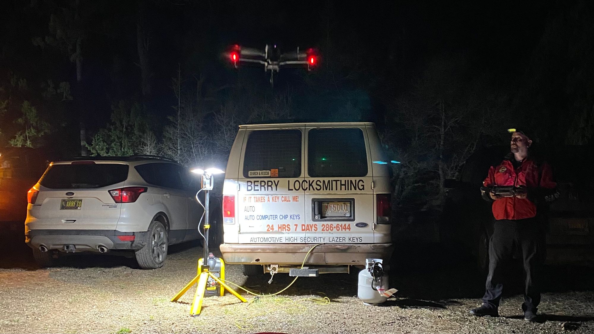
Red and green lights illuminated the drone’s props as it lifted off from its Day-Glo orange launch pad. A ten-foot long piece of nylon 550 cord (also known as “paracord” due to its use in US Army parachutes) dangled from the bottom of the drone. As the drone rose into the air, one could see a cheap Baofeng radio tied to the other end of the 550 cord. In the military, the Baofeng radio became known as the “warlord’s radio,” as the $35 radio was used by members of the Taliban and the Islamic State during the Global War on Terror, and many veterans grew to respect the radio’s capabilities in the harsh mountainous terrain of Afghanistan.
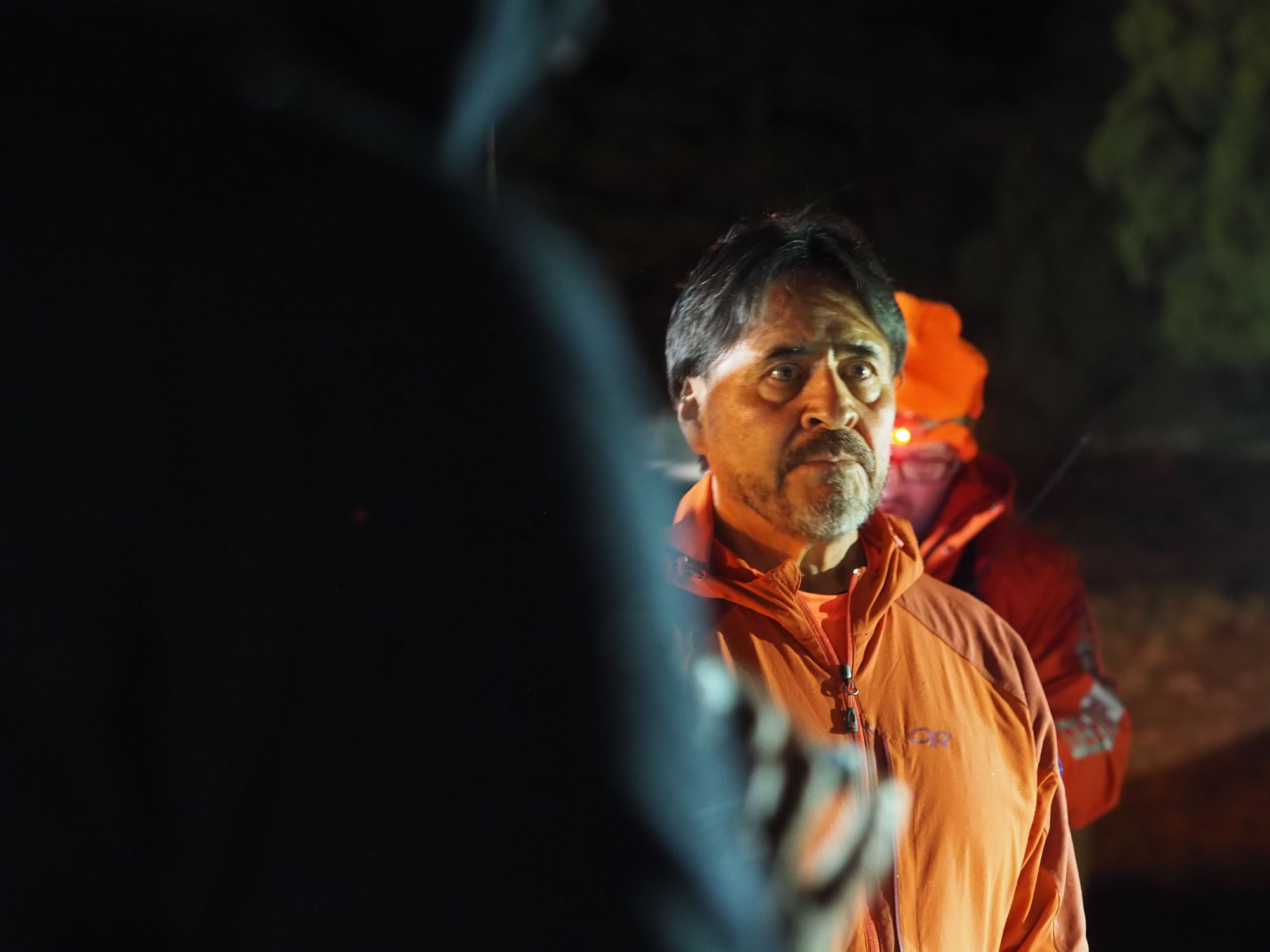
Brad Berry, the locksmith and employee of the New Mexico Office of the Medical Investigator who was piloting the drone, was using the radio tied to its base as a “repeater,” a tool to send radio signals to parts of the search area blocked from communications by ridges. In the past, SAR teams and the military used heavy, 40-foot-tall antennas and fifty pound radio packs to repeat radio signals. Now the same effect could be created by sending a half-pound radio 100 feet into the air. As a bonus, Berry’s drone had forward-looking infrared (FLIR) imagery capabilities, and could spot missing persons by the heat radiating from their bodies. It was nearly 10:00 PM, and the rescuers at the Red Canyon base camp were awaiting word from the hasty search team. If they had gambled wrongly on the search area, the SAR groups would lose hours in cold, rainy weather. From below, the drone was nearly silent, its red and green blinking lights flashing off the pines. Some rescuers gathered around a monitor, watching the FLIR feed from the drone. No one could be seen amidst the grainy black and white footage showing the tops of the trees. Other rescuers chomped on food someone had delivered from one of the gas stations in Estancia. Most had layered on expensive synthetic clothing with the rain’s arrival, and were discussing the various discounts they received on gear. Just as with recreational hikers, the rescuers fixated on how light their gear weighed, reflecting the adage that, on the trail, ounces became pounds.
On the southern end of the base camp, Mountainair’s emergency medical technicians waited in their truck. It was nearly 11:30 PM and the search and rescue incident commander had just announced that the hasty search team had found the lost hiker. Volunteers from New Mexico Mounted Search and Rescue team brought out two horses to assist in moving the hiker, and as the volunteers gathered up gear, one of their horses idly stuck its head into the back of their station wagon. A ripple of jokes washed over rescuers about what the horse wanted, some saying a headlamp, others claiming snacks. Brad Berry had moved on from using his drone as a repeater to demonstrating the drone’s ability to ascend at high speeds, and a small crowd of rescuers gathered to watch its aerial acrobatics.
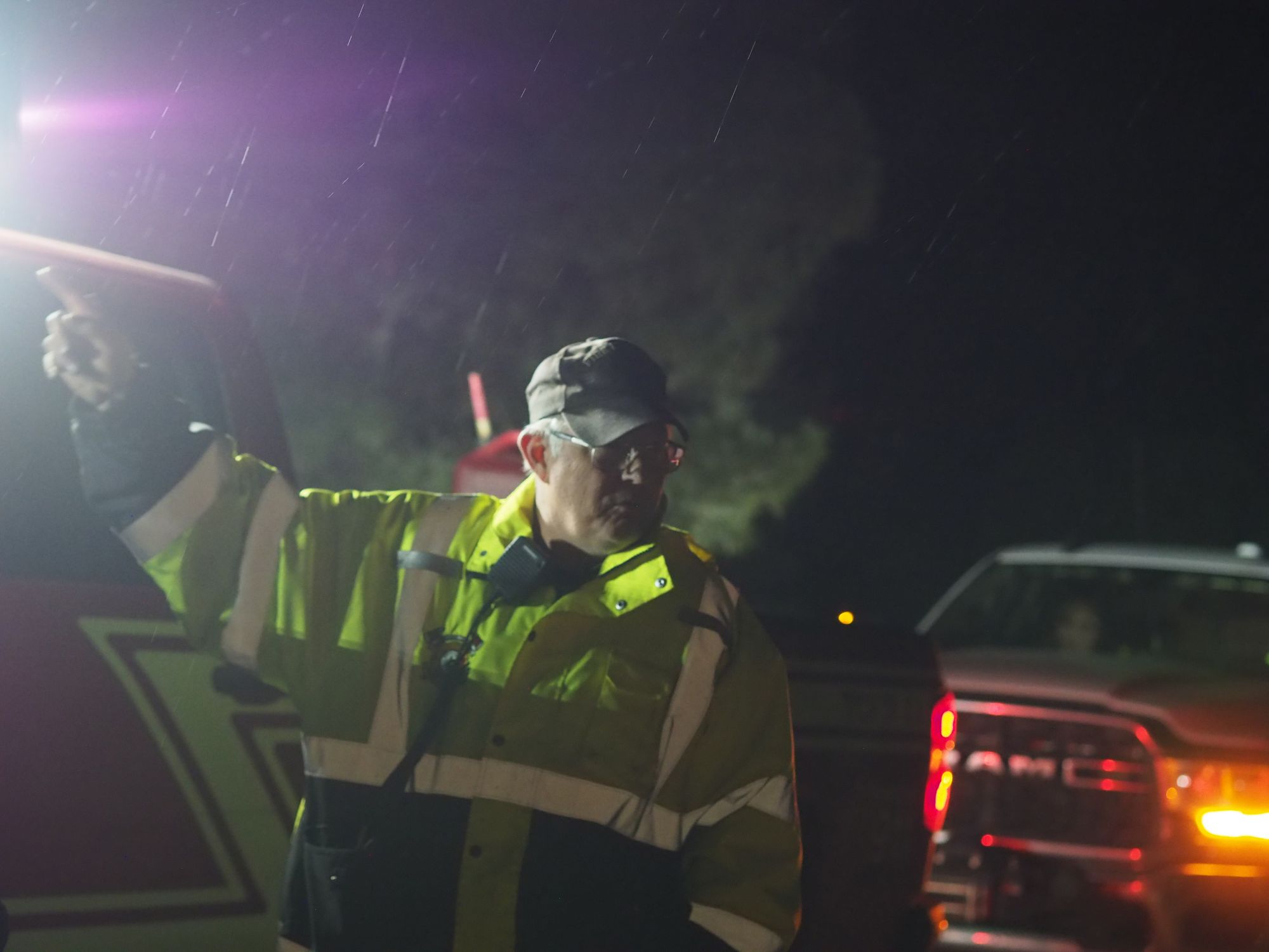
Midnight brought the search effort to its eighth hour. The incident commander relayed to rescuers that they needed to pack up and move their vehicles out from the base camp so that the ambulance could easily move out with the lost hiker. The hiker was half a mile out, the commander explained. A few rescuers talked about the hiker’s poor judgment. “No map, no compass, no food, no water,” said one man, who identified himself as Victor, a former member of the US Army who volunteered with a search and rescue team after he retired. “Even my 10-year-old knows to go downhill when lost in the mountains,” said another. A rescuer who worked as a computer scientist at Sandia National Lab explained she loved volunteering with Albuquerque Mountain Rescue, but it took her away from her husband and infant. “This is common,” she explained of rescuers leaving before the hasty team had brought the missing hiker to base camp. “A lot of times we never find out what happened to the [subject of the search] before it’s over.” A younger rescuer - a female physics student from New Mexico Tech who volunteered with Socorro Search and Rescue - asked if that was true even when they found someone that had died. “It happens,” the first woman said. The two women then began talking about the student’s post-bachelor degree plans.
Brad Berry had packed up his drone and his monitor back in his truck emblazoned with his locksmithing services. His white van’s tires crunched the gravel as he left the Red Canyon Trailhead. Another rescuer got into his car to leave, then fiddled with the stereo of his high-end, custom jeep. His car began playing Beethoven’s 9th Symphony - the famous transcription of the poem “Ode to Joy” - as he rolled down the rocky US Forest Service Road.
At 1:00 AM, Sheldon still had not made his way to base camp. The remaining rescuers on site learned that the EMT who accompanied the hasty search team had reported no injuries, and with this news, many departed in earnest. A largely volunteer effort, most of the rescuers were eager to get some sleep before heading off to work that morning. As adrenaline wore off, rescuers felt the cold, shivering as they returned to ordinary life. Chief Dirks later reported that Torrance County Fire and Mountainair Fire and Rescue personnel would drive Sheldon home much later in the morning, remarking that he had no need for a hospital visit.